The Zanderij Rosetta Stone
How a Declassified NASA Document Reveals Suriname’s True Cold War Secret
Sep 01, 2025
“By the late 1950s, both the United States and the Soviet Union had developed intercontinental ballistic missiles, but satellite navigation systems like GPS weren’t yet up and running. That left military planners with a huge challenge: how to program a missile to hit a target on the other side of the world. Even a tiny mistake could be disastrous.
The maps of the time weren’t up to the task. That’s where geodesy came in.”1
In my previous articles, we’ve explored the long shadows cast by the 1980 Sergeants’ Coup in Suriname, from my own childhood next door to a dictator to the terrifying vulnerability of two U.S. Air Force planes stranded on the tarmac at Zanderij Airport.2 For years, the full story of why that small nation mattered so much to the United States remained clouded.
Now, a recently unearthed document acts as a Rosetta Stone, allowing us to translate scattered clues into a clear and stunning picture. A 1973 NASA Directory of Observation Station Locations, along with declassified CIA memos and diplomatic treaties, reveals the true nature of America’s secret work in Suriname.3 The mission was not about stationing offensive weapons, but something arguably more critical: ensuring America’s nuclear arsenal could actually work as designed.
This is the story of how the jungles of Suriname became a quiet but essential front in the Cold War, a place where the U.S. military undertook a secret, decades-long mission to map the world for nuclear war.
By Matthew Smith is a reader-supported publication. To receive new posts and support my work, consider becoming a free or paid subscriber.

The “Why” – A World of Inaccurate Maps
In the 1950s, the United States faced a terrifying problem. It was building a massive arsenal of Intercontinental Ballistic Missiles (ICBMs), but it couldn’t be sure they would hit their targets.
The reason was simple: the world’s maps were wrong.
Different continents had been mapped using separate systems, called datums. This meant the coordinates for a launch site in North America didn’t perfectly align with the coordinates for a target in the Soviet Union. The difference could cause a missile to miss its target by miles—making it useless against a hardened military site like a Soviet command bunker.4
A 1960 declassified CIA memo spelled out the danger, warning that the U.S. had
a “significant disadvantage in the accurate location of targets” in unmapped regions.5
To fix this, the Department of Defense launched a top-priority mission to create a single, unified map of the entire planet, called the World Geodetic System (WGS).6
Suriname’s location on the shoulder of South America made it a critical link in this global chain. By placing survey stations there, the U.S. could connect the maps of North America, South America, Africa, and Europe, closing a massive “white spot” on the geodetic map.7 The strategic imperative was clear: to make its missiles work, America had to measure the world, and that mission led them directly to Suriname.

The “How” – Boots, Planes, and Antennas in the Jungle
The mission to map Suriname was a massive undertaking, executed by elite U.S. military units and civilian contractors over several decades. This modern American effort built upon a foundation laid just after World War II, when KLM Aerocarto flew the first comprehensive aerial photography missions in 1947, establishing what was known as the Paramaribo Datum of 1947.
The main force was the U.S. Air Force’s 1370th Photo-Mapping Wing, a specialized unit tasked with global geodetic surveys.8 Starting around 1960, a detachment of roughly 12 officers and 117 men began “Project 54-AFS-50” out of Zanderij Airfield.9 They used a high-tech aerial survey method called HIRAN, flying aircraft between remote ground stations to measure distances with incredible precision.10
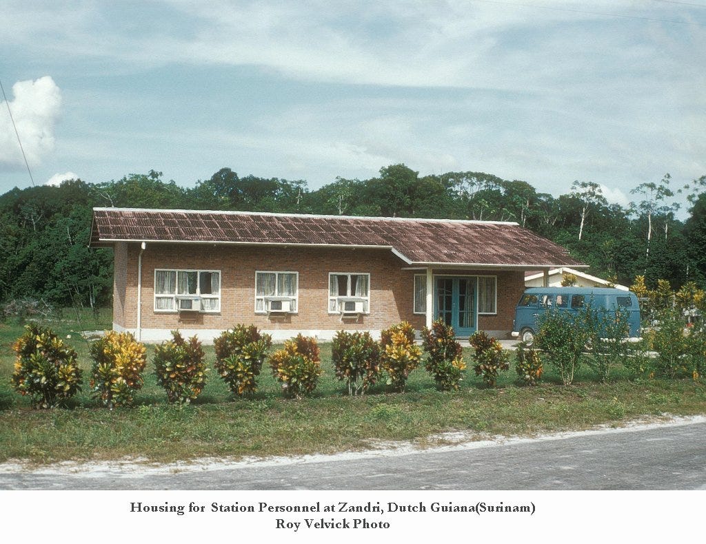
The main ground station was established at Zanderij, a key node in the network that would culminate in a new, highly accurate local system called the Zanderij Datum of 1962.11 According to geodetic expert John W. Hager, the station was officially designated “HIRAN 14 AMS 1962.”12
As technology evolved, the Zanderij hub was upgraded for the space age. The NASA Directory confirms the site hosted a suite of advanced satellite tracking systems:
- A SECOR station (No. 5712) run by the U.S. Army, which used radio waves to measure distances to satellites.13
- A BC-4 ballistic camera (No. 6008), which photographed satellites against the stars to calculate their exact position.14
- Other camera and Doppler systems run by the U.S. Navy and Air Force.
This complex operation required a significant logistical backbone. Support was provided by a surprising civilian contractor: Pan American World Airways’ Guided Missiles Range Division (PAA-GMRD). This was the same division that managed the Cape Canaveral missile range for the Air Force. Pan Am flights routinely used Zanderij as an official transit hub to support the U.S. Atlantic Missile Range, ferrying personnel and supplies.15 This provided a perfect cover and an existing pipeline for the secret mapping mission happening at the very same airfield.

The “Permission” – The Diplomatic Fine Print
This multi-decade U.S. military operation could not happen without official permission from the Kingdom of the Netherlands, which governed Suriname until 1975. The legal foundation for the mission was an “Exchange of Notes” signed on April 24, 1962.16
This document functioned as a discreet Status of Forces Agreement, granting the U.S. government the right to:
- Fly unarmed military aircraft over Suriname and use Zanderij Airfield.17
- Station U.S. personnel in the country to perform necessary functions.18
- Operate these missions without paying landing fees, in exchange for reimbursing Suriname for the use of the facilities. The reimbursement was made retroactive to May 1, 1960, proving the mission had been underway for two years before the agreement was even signed.19
This arrangement was a classic Cold War quid pro quo. The U.S. gained access to a politically stable, geographically vital location for a top-secret program. In return, the Netherlands solidified its security relationship with its most powerful NATO ally, and Suriname received investment in its main airport and access to improved maps of its own country.
The Enigma of Mamia Pakoro—A Cover Story and a Global Pattern
While the official U.S. mission at Zanderij is now clear from the documentary record, the story of the American presence in Suriname has one more chapter—one that unfolds far from the official files, deep in the jungle. This is the enigma of Mamia Pakoro, a remote airstrip that does not appear on official survey maps but whose existence points to a clandestine layer of the U.S. geodetic mission.
A 1967 article in the “Amigoe di Curacao” newspaper provides the perfect official cover story.20 It announced that the Surinamese government had signed an agreement with an American named Curtis O. Meyers to establish a 5,000-hectare cattle ranch in the Sipaliwini Savanna, the same remote area as Mamia Pakoro. The plan, the article noted, explicitly included transporting about 100 cattle to the site “by airplane.”21
The economic viability of a cattle ranch entirely dependent on air transport is highly questionable. However, it provides a perfect, publicly documented justification for an American-controlled airstrip. The timing is also critical; 1967 is exactly when the U.S. geodetic mission was escalating its satellite tracking operations, increasing the value of a deniable, off-the-books asset.
This story is not an isolated anomaly. A striking parallel exists in a 2012 article from the Monthly Notes of the Astronomical Society of Southern Africa. The author describes his accidental 1966 discovery of “STATION 13,” a secret U.S. military satellite tracking installation near Pretoria, South Africa, the author dubs “South Africa’s Area 51.”22 This confirms a global pattern of the U.S. establishing small, semi-secret technical outposts under deep cover to support its worldwide strategic missions. The evidence strongly suggests Mamia Pakoro was the secret HIRAN Station 15, a clandestine but essential part of the same geodetic mission being run from Zanderij.23

The Quiet Front
The evidence is now clear. For nearly four decades, the United States operated a quiet but critical front in the Cold War from the jungles of Suriname. This mission, hidden behind a veil of scientific cooperation and clever cover stories, was directly linked to the strategic imperative of ensuring America’s nuclear arsenal could function with deadly precision. This vast, secret architecture of global power—a web of diplomacy, military operations, and private enterprise—demonstrates how the abstract science of geodesy was weaponized in the service of nuclear strategy. The unresolved questions surrounding Curtis O. Meyers and the full extent of this global network underscore that even now, parts of this history remain concealed, awaiting the next discovery.
Want to learn more about the secret Cold War history of Suriname? Check out “The Suriname Contra Affair: Part I.”
By Matthew Smith is a reader-supported publication. To receive new posts and support my work, consider becoming a free or paid subscriber.
Endnotes
Culture. “How the U.S. Air Force Mapped the World at the Dawn of the Cold War.” September 1, 2025. https://web.archive.org/web/20210508063622/https://www.nationalgeographic.com/culture/article/air-force-world-maps-cold-war.
Matthew Smith, “The Secret War for Suriname: Part I,” The Secret War for Suriname (Substack newsletter), April 24, 2025.
National Aeronautics and Space Administration, NASA Directory of Observation Station Locations, Volume 2, 3rd ed. (Greenbelt, MD: Goddard Space Flight Center, November 1973).
Central Intelligence Agency, “Brief Explanation of Geodetic Target Error for the ICBM in Relating Launch and Target Points on Different Continents,” CIA/RR GP 60-100, October 21, 1960, declassified.
Ibid.
“Chapter VIII: The World Geodetic System,” in Geodesy for the Layman, (Washington, D.C.: National Geodetic Survey, 1984).
A.S.P.R.S., “The Republic of Suriname: Grids & Datums,” Photogrammetric Engineering & Remote Sensing, November 2019.
Aerospace Cartographic and Geodetic Service, “Unit History,” USAF Unit Histories, accessed August 31, 2025.
KWB’s Blog, quoting Dutch archival excerpts on the October 15, 1959 meeting between Joseph Luns and the Surinamese Government.
“How the U.S. Air Force Mapped the World at the Dawn of the Cold War,” National Geographic, October 22, 2018.
NASA, Directory of Observation Station Locations, lists HIRAN Station 14 at Zanderij.
Clifford J. Mugnier, “Grids and Datums: The Republic of Suriname,” Photogrammetric Engineering & Remote Sensing 85, no. 11 (November 2019): 784–785. The original HIRAN Station 14 designation is found in the NASA Directory of Observation Station Locations.
Ibid., lists SECOR Station 5712 at Paramaribo.
Ibid., lists BC-4 Camera Station 6008 at Paramaribo.
Pan Am Historical Foundation, “The Race To Space,” accessed August 31, 2025. Cites Pan Am’s role in flying personnel to downrange tracking stations via Suriname.
Exchange of Notes between the Government of the Kingdom of the Netherlands and the Government of the United States of America constituting an Agreement on the use of Zanderij airport (Suriname) by United States military aircraft, April 24, 1962, Netherlands Treaty Database.
Ibid.
Ibid.
Ibid., notes the agreement was made retroactive to May 1, 1960.
“Slachtrundveebedrijf,” Amigoe di Curacao, May 20, 1967, 2.
Ibid.
Greg Roberts, “Station 13—South Africa’s Area 51?, ” Monthly Notes of the Astronomical Society of Southern Africa 71, no. 3-4 (April 2012): 79-81.
A special acknowledgment is due to ‘Kenneth Blesch’s Blog,’ whose dedicated archival work helped identify crucial documents used in this article. They successfully unearthed the primary source documents—including the 1959 secret minutes and the PAA-GMRD connection—that make this story possible to tell.
Where my analysis diverges, however, is in the interpretation of these finds. While the original researcher posits a compelling theory of secret missile bases and complex geometric alignments, I believe the documentary evidence points to a different, though equally strategic, reality. My article focuses on the hard facts presented in these documents to tell the verifiable story of Suriname’s crucial role in the Cold War’s technological arms race.
Source:
Link:
Internal Link: